Glencoaghan River
Posted: Sat Jun 19, 2010 4:34 pm
Myself and Ross took a walk up the Glencoaghan Valley to check out the river. The valley is about 60km from Galway, less than and hour by car, on the Galway to Clifden road.
We parked about halfway up the valley. We then walked down to the river. You can see our elevation path on the graph below.
The lowest point on the graph represent where we met the river after walking down from the road. We then proceeded up the valley from there.
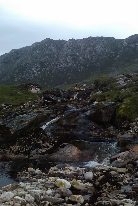
As soon as we reached the river, we discovered a rapid, a double drop, which I have named BingBoing. This drop has a solid rock bed, with plenty of gradient. All that is needed is water
We continued up the valley, just after BoingBoing there is a flat bog plateau. The river changes character here, the bed is made up of shale, gravel and sand. The bog looks like it has this bed a porous layer underneath. The flowing river disappeared at this point, and separated into tributaries and dried gravel bed. It seems like the bog absorbed the river.
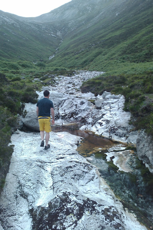
We didn't plan on hiking up the valley, but each time we travelled further up, we saw something of interest. The next section starts when the gradient picks up again, the river again has a solid rock bed. There is a unbelievably continuous rapid that would be wicked if it had enough water. Part of the rapid can be seen in this photo.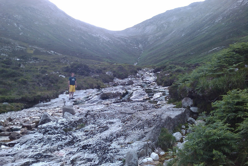
The next section get even steeper, with the valley narrowing. There are several sizeable tributaries, cut into the walls of the valley. As if the torrents of rain that have flowed down them were made from acid. The bed of the river was more bolder like than the smooth flat bedrock in the section below.
We didn't go the full way up, the gradient was getting higher and we hand planed on such a core hike. And I would guess that the potential for a viable run this far up the valley was limited to once in a hundred year floods.
(having said that, lately we've been getting 'once in a hundred years floods' regularly in these parts )
)
We went back to the car and drove down to investigate the rapid below the bridge.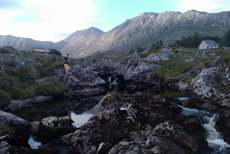
This rapid most definitely runs, the entire valley drains through this bridge. The bed of the rapid is solid rock and there is a massive undercut rock at the bottom of a drop at the end of the rapid.
Here a Google map with each of the photos pinpointed on the map.
Conclusion
The highest up rapids might run, but I'd say it would require very heavy rain. And it would run off quickly.
The rapids just below that, just before the bog, are continuous and have a very good width and gradient. So of the Rivers I've seen in Connemara have flat smooth beds and good gradient, also are very very wide, meaning they could never really run. This isn't the case for this rapid. It also has a sizeable portion of the valley draining into it.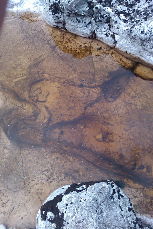
The bed of this section has also seen a lot of action, pothole type holes can be seen in many places.
The next rapid is BoingBoing and whatever lies between that and the bridge. It definitely runs. My guess is that it would just require a normal rain fall to run.
Below the bridge looks hairy enough, but who knows what it would look like with some water on it. This rapid definitely runs. I can only imagine what it looks like after heavy rain.
The Glencoaghan valley reminds me of the Srahnalong valley, it has steep walls and it looks like its a funnel cut in half, purposefully built for collecting water.
If there is rain any day soon I'll be taking a trip out here to see whats happening.
As soon as we reached the river, we discovered a rapid, a double drop, which I have named BingBoing. This drop has a solid rock bed, with plenty of gradient. All that is needed is water
We continued up the valley, just after BoingBoing there is a flat bog plateau. The river changes character here, the bed is made up of shale, gravel and sand. The bog looks like it has this bed a porous layer underneath. The flowing river disappeared at this point, and separated into tributaries and dried gravel bed. It seems like the bog absorbed the river.
We didn't plan on hiking up the valley, but each time we travelled further up, we saw something of interest. The next section starts when the gradient picks up again, the river again has a solid rock bed. There is a unbelievably continuous rapid that would be wicked if it had enough water. Part of the rapid can be seen in this photo.
The next section get even steeper, with the valley narrowing. There are several sizeable tributaries, cut into the walls of the valley. As if the torrents of rain that have flowed down them were made from acid. The bed of the river was more bolder like than the smooth flat bedrock in the section below.
We didn't go the full way up, the gradient was getting higher and we hand planed on such a core hike. And I would guess that the potential for a viable run this far up the valley was limited to once in a hundred year floods.
(having said that, lately we've been getting 'once in a hundred years floods' regularly in these parts
We went back to the car and drove down to investigate the rapid below the bridge.
This rapid most definitely runs, the entire valley drains through this bridge. The bed of the rapid is solid rock and there is a massive undercut rock at the bottom of a drop at the end of the rapid.
Here a Google map with each of the photos pinpointed on the map.
Conclusion
The highest up rapids might run, but I'd say it would require very heavy rain. And it would run off quickly.
The rapids just below that, just before the bog, are continuous and have a very good width and gradient. So of the Rivers I've seen in Connemara have flat smooth beds and good gradient, also are very very wide, meaning they could never really run. This isn't the case for this rapid. It also has a sizeable portion of the valley draining into it.
The bed of this section has also seen a lot of action, pothole type holes can be seen in many places.
The next rapid is BoingBoing and whatever lies between that and the bridge. It definitely runs. My guess is that it would just require a normal rain fall to run.
Below the bridge looks hairy enough, but who knows what it would look like with some water on it. This rapid definitely runs. I can only imagine what it looks like after heavy rain.
The Glencoaghan valley reminds me of the Srahnalong valley, it has steep walls and it looks like its a funnel cut in half, purposefully built for collecting water.
If there is rain any day soon I'll be taking a trip out here to see whats happening.